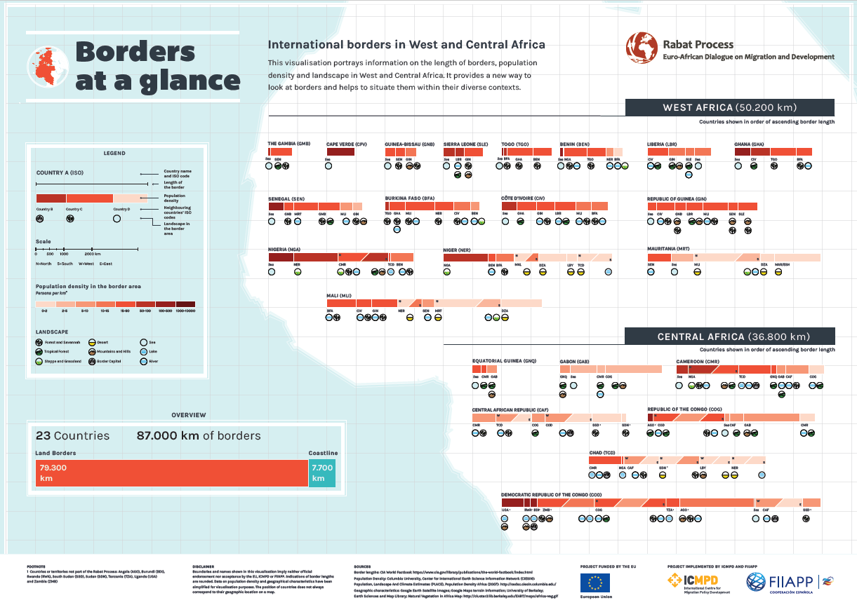
This infographic provides key information on international borders in West and Central Africa. Instead of depicting borders as a map, it provides a new way to look at borders and helps to situate them in diverse contexts.
For each African Rabat Process partner country, the infographic features the following three indicators:
- Lengths of borders, depicted proportionately through the lengths of the bars
- Population density, depicted through the color of the bars
- Landscape in the border area, depicted through icons
This infographic is part of a series aiming at sharing knowledge and good practices between actors concerned by migration and development questions. It was funded by the EU and elaborated by a consortium involving ICMPD and FIIAPP, in the framework of the third phase of the Rabat Process Support Project.
Consult and download the infographic: Borders at a glance

